Phantom 4 Multispectral Quadcopter - DJI
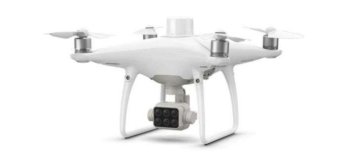
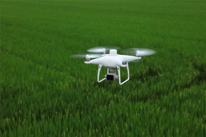
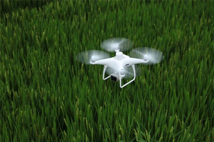
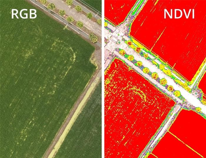
The Phantom 4 Multispectral drone is designed to obtain high-precision data from different spectral channels for the agricultural sector and environmental monitoring. This small drone solves problems related to precision farming and monitoring the fertilizer application cycle.Phantom 4 Multispectral is the most advanced solution for agriculture. This drone receives and processes data from 6 cameras, which allows you to analyze: the germination of both individual plants and entire crops, the presence of weeds and insect pests, and the general condition of the soil. The resulting data from multispectral cameras and vegetation index data (NDRE and NDVI) allows you to make effective decisions on crop management, reduce costs, save resources and maximize yields.
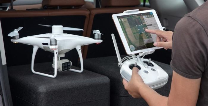
With GS Pro (iOS app), you can create flight routes, automate tasks, and manage flight data. The remote pilot can easily switch between the pre-normalized relative vegetation index (NDVI) image and the RGB (visible radiation) model to get accurate data on problem areas in real time.
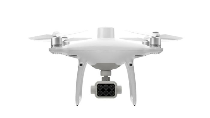
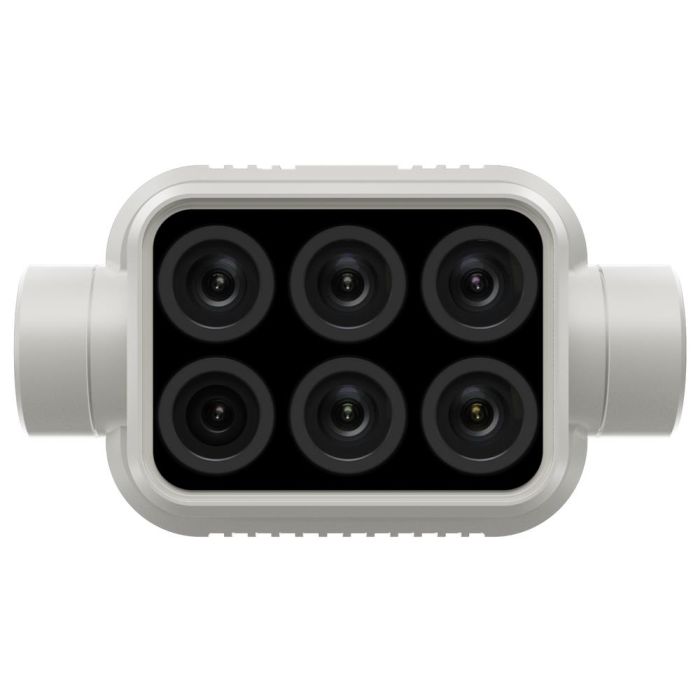
To obtain accurate data at any time of the day, a sunlight sensor is installed on the top of the drone. When combined with post-processing data, this information helps produce the most accurate NDVI results. The built-in camera is capable of collecting complete and accurate data on the condition of crops without additional settings. Information is collected from an RGB camera and 5 multispectral cameras with the following channels: blue, green, red, red edge and near-infrared. All cameras are equipped with a global shutter with a resolution of 2 MP and are located on a 3-axis stabilizer. All cameras are carefully calibrated with radial and tangential distortion measured. Distortion parameters are stored in the metadata of each image, which allows you to apply an individual approach in each individual case when processing images.
P4 Multispectral is equipped with a 5-way obstacle detection system to ensure safe flight. Thanks to the OcuSync system, P4 Multispectral transmits a signal over a distance of up to 7 km. The RTK module ensures precise positioning of the drone. TimeSync continuously synchronizes the flight controller, RGB and NB cameras, and RTK module. This ensures the most accurate metadata is used and positioning is centered in CMOS. By operating the P4 Multispectral with a D-RTK 2 mobile station, RTK positioning accuracy can be easily improved without an Internet connection via the NTRIP protocol (network RTCM transmission over the Internet and 4G or WiFi hotspot. The system is capable of storing satellite data for subsequent kinematics processing.
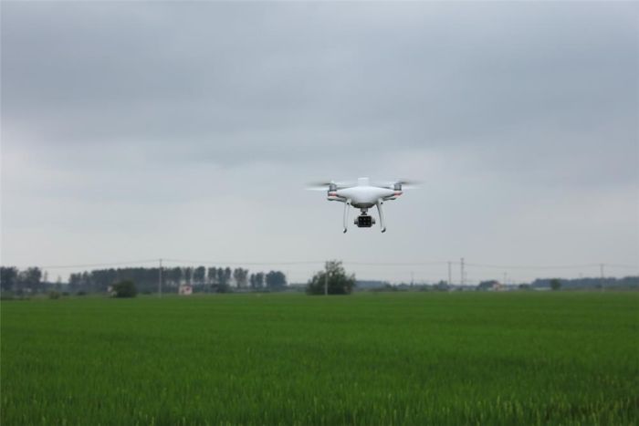
P4 Multispectral allows you to obtain multispectral images of large areas to identify problem areas. Maps of differentiated application of fertilizers will allow you to target fields exactly in those places where it is really needed and significantly save costs. The digital model obtained using P4 Multispectral can be used as a substrate for AGRAS series agricultural drones, increasing the accuracy of their flight.
Specifications
Drone
Takeoff weight | 1487 g |
|---|---|
Diagonal size (without propellers) | 350 mm |
Max. altitude above sea level | 19,685 ft (6,000 m) |
Max. climb speed | 6 m/s (automatic flight); 5 m/s (manual control) |
Max. rate of descent | 3 m/s |
Max. speed | 50 km/h (P mode); 58 km/h (mode A) |
Max. flight time | About 27 minutes |
Operating temperature range | 0°...+40°C |
Operating frequency range | 2.4–2.4835 GHz (Europe, Japan, Korea) |
Transmitter Power (EIRP) | < 20 dBm (CE/MIC/KCC) |
Positioning accuracy | The RTK system is turned on and operating properly: Vertical: ±0.1 m; horizontal: ±0.1 m Without RTK: vertical: ±0.1 m (visual positioning); ±0.5 m (satellite positioning); in the horizontal plane: ±0.3 m (visual positioning); ±1.5 m (satellite positioning) |
Image Position Alignment | The relative positions of the centers of the six CMOS sensors and the center of the airborne D-RTK antenna are calibrated and recorded in EXIF format for each image. |
Satellite positioning systems
Single Frequency High Sensitivity Satellite Positioning System | GPS + BeiDou + Galileo (Asia); GPS + GLONASS + Galileo (other regions) |
|---|---|
Multi-band, multi-system, high-precision RTK satellite positioning systems | GPS frequency used: L1/L2; GLONASS: L1/L2; BeiDou: B1/B2; Galileo[2]: E1/E5 Initial recorded time: < 50 sec Positioning accuracy: 1.5 cm + 1 ppm vertical (rms); 1 cm + 1 ppm horizontal (rms). 1 ppm means that the error increases by 1 mm for every 1 km of movement. Speed accuracy: 0.03m/s |
Map creation functions
Ground Surface Pixel Size (GSD) | (H/18.9) cm/pixel, where H is the height of the drone in relation to the mapped area (unit: m) |
|---|---|
Data collection | Max. operating area is about 0.47 km for one flight at an altitude of 180 m, i.e. GSD is about 9.52 cm/pixel |
Stabilizer
Operating range of rotation angles | Tilt: -90°...+30° |
|---|
Vision system
Max. speed | ? 50 km/h at a height of 2 m above the ground in good lighting |
|---|---|
Max. height | 0–10 m |
Operating range | 0–10 m |
Obstacle detection range | 0.7–30 m |
Operating conditions | Surface with visible texture, illumination level > 15 lux |
Camera
| Matrices | Six 1/2.9-inch CMOS sensors, including one RGB visible light sensor and five monochrome sensors for multispectral imaging. Number of effective pixels per sensor: 2.08 million (total number of pixels: 2.12 million). |
|---|---|
| Filters: | Blue (B): 450 nm ± 16 nm, green (G): 560 nm ± 16 nm, red (R): 650 nm ± 16 nm, red edge (RE): 730 nm ± 16 nm, near-infrared (NIR): 840 nm ± 26 nm |
| Lenses | Viewing angle: 62.7° Focal length: 5.74 mm (40 mm - equivalent to 35 mm format), autofocus set to ? Aperture: f/2.2. |
| RGB Matrix ISO Range | 200–800 |
| Monochrome matrix gain | 1–8x |
| Electronic global shutter | 1/100–1/20000 s (standard camera); 1/100–1/10000 s (multispectral cameras) |
| Max. image resolution | 1600*1300 (4:3.25) |
| Photo formats | JPEG (standard images) + TIFF (multispectral image processing) |
| Supported File Systems | FAT32 (? 32 GB); exFAT (> 32 GB) |
| Types of memory cards | microSD with a minimum write speed of 15 MB/s. Max. volume: 128 GB. Speed class: Class 10, supports UHS-1. |
| Operating temperature range | 0°...+40° C |
Remote Control
Operating frequency range | 2.4–2.4835 GHz (Europe, Japan, Korea) |
|---|---|
Transmitter Power (EIRP) | < 20 dBm (CE/MIC/KCC) |
Max. signal transmission range | FCC/NCC: 7 km; CE/MIC/KCC/SRRC: 5 km (no obstacles or interference) |
Built-in battery | 6000 mAh Li-polymer 2S |
Operating current/voltage | 1.2 A at 7.4 V |
Mobile device holder | Tablets and smartphones |
Operating temperature range | 0°...+40°C |
Battery INTELLIGENT FLIGHT BATTERY (PH4-5870 MAH-15.2 V)
Capacity | 5870 mAh |
|---|---|
Voltage | 15.2 V |
Type | Lithium polymer 4S |
Energy | 89.2 W/h |
Net weight | 468 g |
Operating temperature range | -10°...+40°C |
Charging temperature range | +5°...+40°C |
Max. charging power | 160 W |
Charging hub
Voltage | 17.5 V |
|---|---|
Operating temperature range | +5°...+40°C |
AC adapter (PH4C160)
Voltage | 17.4 V |
|---|---|
Rated power | 160 W |
Phantom 4 Multispectral accessories:
- Stabilizer lock
- MicroSD memory card
- Vicro USB cable
- Shipping container


